Contact Us
|
WeChat
WeChat ID:842122368Scan to Connect
WeChat ID:842122368Scan to Connect

Unmanned aerial vehicles (UAVs) originated in military applications and experienced rapid advancement throughout the 1990s. Since the early 2000s, continuous technological evolution has driven drones toward miniaturisation, lower‑altitude operation, simplified design, reduced technical complexity, and decreasing cost. These trends—combined with inherent advantages such as elevated vantage points, high speed, terrain indifference, strong environmental adaptability, and ease of modification—have accelerated widespread civilian adoption.
However, this proliferation has also led to a surge in unauthorised and reckless drone operations, which now routinely disrupt national air defence warning systems, causing substantial waste of manpower, material, and financial resources. More critically, rogue UAV activity poses unprecedented risks to critical infrastructure protection, urban airspace security, military and civilian aviation safety, and overall public order. Developing reliable drone detection and countermeasure systems—alongside appropriate regulatory frameworks—has therefore become an urgent priority for enabling legitimate UAV operations while effectively neutralising illicit threats.
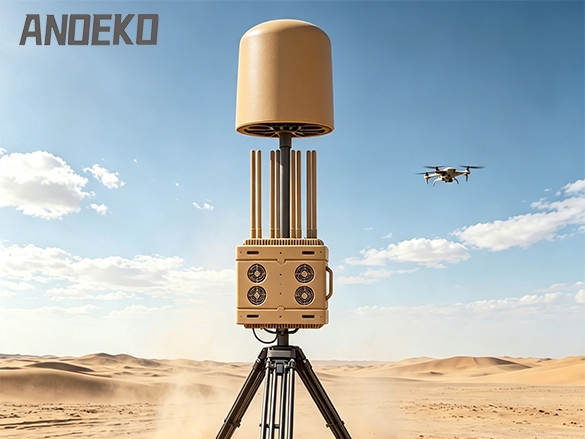
Effective detection is the cornerstone of any counter‑UAV strategy. Current methodologies fall into four principal categories: acoustic recognition, optical/infrared sensing, radar detection, and radio frequency (RF) spectrum monitoring.
During flight, a drone’s motors and spinning rotors generate characteristic noise, predominantly concentrated in the 0.3 kHz to 20 kHz range. Acoustic detection exploits this signature through two primary approaches:
Audio Fingerprint Identification: Each drone produces a unique “audio fingerprint”—the distinct acoustic profile of its propeller rotation. By deploying microphones to monitor target areas and comparing captured audio against comprehensive databases of known drone acoustics, systems can not only detect the presence of a UAV but also identify its specific model. However, this method requires exhaustive acoustic libraries covering all drone types—including military and custom‑built variants—to minimise false alarms. Typical effective detection range remains under 200 metres, with only a few systems extending to 1 kilometre.
Acoustic Array Reception: Using multi‑element microphone arrays to capture and process airborne acoustic signals enables classification and identification through correlation processing and data fusion. Drone acoustic signatures exhibit continuous time‑domain characteristics with distinct frequency line spectra whose fundamental components correlate directly with rotor speed. Systems employing high‑sensitivity transducers, multi‑channel high‑speed acquisition cards, and advanced correlation algorithms can achieve reliable detection and tracking at ranges of approximately 200 metres.
Optical detection combines visible‑light cameras and thermal infrared imaging sensors to detect UAVs through either reflected visible light or thermal emissions. Advanced systems integrate beyond‑visual‑range high‑magnification optics, DOE‑based infrared point‑target tracking, high‑definition laser‑scanning image recognition algorithms, and precision servo‑driven gimbal technology. This enables all‑weather, full‑coverage video surveillance capable of detecting, classifying, and tracking small, low‑altitude, slow‑flying UAVs at ranges up to 2 kilometres.
Nevertheless, the compact dimensions of modern drones result in low infrared signatures, significantly reducing detection range for thermal systems. Moreover, drones can employ radar‑absorbent materials, light‑diffusing coatings, and stealth‑oriented geometries that further complicate optical and infrared acquisition.
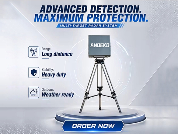
Radar systems—typically operating in S, X, or Ku bands to match UAV radar cross‑section (RCS) profiles—detect drones by transmitting electromagnetic waves and analysing reflections. Effective ranges can reach several kilometres. Balloon‑borne radar platforms offer particular utility for low‑altitude target detection due to their elevated positioning and operational flexibility.
Nevertheless, radar‑based drone detection faces significant challenges. Contemporary UAVs are predominantly constructed from foam, lightweight wood, and composite materials that exhibit low reflectivity—effectively making them stealth platforms. Their already‑minimal RCS, combined with slow flight speeds that produce negligible Doppler shift, dramatically reduces detection probability and range. Low‑altitude clutter, ground‑level blind zones, and susceptibility to meteorological and environmental interference further degrade radar performance. When drones operate at altitudes of just tens to hundreds of metres, ground‑based radar struggles to achieve reliable long‑range detection and tracking.
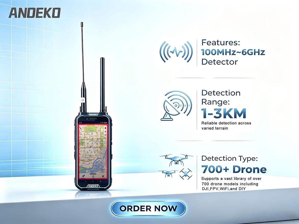
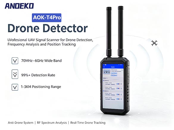
Drones rely on two primary RF links for operation: the control link (typically 2.4 GHz for command transmission) and the video/data link (which transmits telemetry, position data, battery status, and camera feeds, often via 5.8 GHz or other frequencies). Additionally, GNSS positioning signals (GPS, BeiDou, GLONASS) are received and processed onboard. RF spectrum monitoring detects drones by identifying these characteristic emissions.
This approach offers several compelling advantages: it applies universally across all drone types, supports 24/7 continuous monitoring, and can detect signals even when drones are concealed behind buildings, vegetation, or other obstacles. Importantly, RF monitoring can also locate the drone operator by tracking the control link origin.
Typical detection ranges for commercial systems are approximately:
2.4 GHz control signals: 1–2 km
433/868/920 MHz telemetry signals: 2–3 km
5.8 GHz video links: 1 km
Critical Limitation: If a drone operates in RF‑silent mode—transmitting no control, telemetry, or video signals—electromagnetic spectrum monitoring cannot detect it.

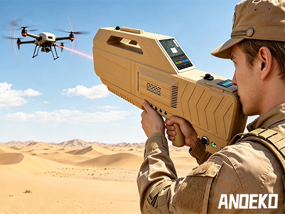
To neutralise rogue UAVs, countermeasure systems typically target two fundamental vulnerabilities: the remote control link and the satellite navigation (GNSS) reception.
Remote control signals are significantly stronger than GNSS signals, but the control receiver antenna’s main lobe typically points downward toward the ground—unlike GNSS antennas which point skyward, providing some isolation from ground‑based interference. Modern remote control transmitters increasingly employ frequency‑hopping spread spectrum (FHSS) and direct‑sequence spread spectrum (DSSS) with adaptive hopping parameters, conferring substantial interference immunity.
Three primary interference approaches exist:
3.1.1 Broadband Noise Jamming
When the jammer lacks knowledge of hopping parameters, full‑band noise coverage is required. For a drone at 100 metres with a 3 dBi antenna, the required power approximates the control transmitter power (~0.1 W) for correlated interference. For frequency‑hopping signals without parameter knowledge, full‑band noise coverage typically demands approximately 30 dB higher power (~100 W) —significantly increasing system cost and potentially disrupting other legitimate radio communications. Moreover, advanced transmitters can adaptively hop frequencies in response to interference, rendering narrowband jamming increasingly ineffective.
3.1.2 Blocking Interference
Blocking interference exploits the receiver’s front‑end limitations—out‑of‑band signals that exceed the receiver’s linear dynamic range degrade sensitivity to in‑band signals. Spread‑spectrum and frequency‑hopping techniques do not improve blocking immunity; in fact, wider front‑end bandwidths make receivers more susceptible. Civilian receivers, optimised for sensitivity and power efficiency, typically use simple filtering before low‑noise amplifiers and mixers—components with limited dynamic range. An interfering signal of approximately ‑20 dBm, even slightly detuned from the receive frequency, can reduce sensitivity by 6 dB. Higher‑power interference can completely overwhelm reception or, without proper limiting circuitry, permanently damage the receiver.
3.1.3 Spot Jamming
Spot jamming delivers precisely targeted interference at the instantaneous frequency of the control signal. A surveillance receiver continuously monitors the RF band; upon detecting a control signal, it directs a jammer to transmit at that specific frequency. After a brief interval (e.g., 1 ms), jamming pauses while the receiver reacquires the signal—if the frequency has hopped, the jammer updates accordingly. This approach offers significant advantages: no transmission when no threat exists, extremely low interference power requirements (often equal to or slightly above the control signal level), and minimal environmental impact. For non‑spread‑spectrum signals, jamming power comparable to the received signal suffices; for spread‑spectrum signals (with modest processing gain), approximately 20 dB above signal level is typically adequate.
Drones rely on satellite navigation signals (GPS, BeiDou, GLONASS) for position determination, attitude stabilisation, flight path execution, and telemetry reporting. Newer GNSS modules support multi‑constellation operation; older units typically use at least GPS.
GPS signals arrive at the Earth’s surface below the natural noise floor. With a typical 3–6 dBi passive antenna in open terrain, maximum received signal level is approximately ‑120 dBm. Civilian GPS uses a 2.046 MHz bandwidth spread‑spectrum signal at 1575 MHz with 43 dB processing gain. For effective full‑band noise jamming—where the interference signal bandwidth equals or exceeds 2.046 MHz—the received interference power must exceed ‑83 dBm to achieve a bit error rate above 10 %.
Operational Considerations: For drones operating in autonomous pre‑programmed mode, GNSS denial prevents route adherence. For manually piloted drones, GNSS denial degrades stability—particularly in turbulent conditions. Given the increasing prevalence of multi‑constellation GNSS receivers, effective countermeasures must simultaneously address GPS, BeiDou, and GLONASS bands.
Interfering with the drone’s video and telemetry downlink presents a more challenging tactical situation than control‑link jamming. The interference target is the operator’s receiver—typically located at a distance from the drone greater than or comparable to the drone’s distance from the operator. Furthermore, the drone operates at altitudes of tens to hundreds of metres with favourable propagation conditions, while ground‑based jammers suffer from terrain and clutter attenuation. Operators may also employ directional antennas aimed at the drone or adaptive nulling antennas to reject interference.
Beyond electronic warfare approaches, physical capture offers an alternative for neutralising rogue drones without causing collateral damage.
Raptor‑Based Capture: Dutch authorities, in collaboration with Guard from Above, have trained eagles to intercept and retrieve unauthorised drones. Leveraging the birds’ natural hunting instincts and aerial agility, trained raptors capture drones mid‑flight and transport them to safe areas.
Drone‑vs‑Drone Capture: The University of Michigan pioneered UAV‑borne capture nets. Japan subsequently established specialised “anti‑drone squads” employing net‑equipped drones—such as the DJI Spreading Wings 900—to capture rogue UAVs in mid‑air and return them safely to ground. Tokyo police reportedly planned to deploy ten such systems by early 2017 for airspace security around critical government facilities.

The dual imperatives of enabling legitimate drone operations and neutralising unauthorised threats demand a layered, technology‑neutral approach to UAV defence. Effective detection—whether through acoustic, optical, radar, or RF spectrum means—provides the essential situational awareness upon which all countermeasures depend. Countermeasure strategies must address both the remote control link and GNSS reception, with deployment decisions guided by the specific operational environment, threat profile, and regulatory constraints.
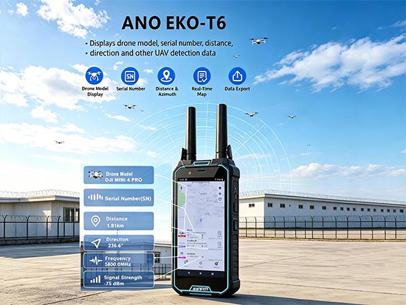
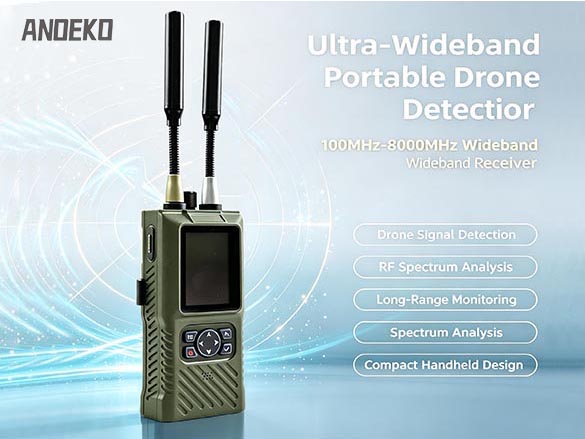
Organisations such as ANOEKO are at the forefront of this evolving landscape, delivering integrated anti‑drone solutions—including signal jammers, portable detectors, anti‑FPV systems, RF amplifiers, multispectral tracking turntables, and specialised antennas—that address the full spectrum of detection and neutralisation requirements. With in‑house R&D and full supply‑chain control spanning raw materials through production, testing, logistics, and after‑sales support, ANOEKO provides customised systems serving airports, border security, petrochemical facilities, power grids, and urban safety applications. As drone technology continues its rapid evolution, the development of sophisticated, multi‑layered counter‑UAV capabilities remains essential for protecting critical infrastructure, ensuring aviation safety, and preserving public security.
Consultation Hotline
+86 18948793112
Email:lisen1205@foxmail.com
Mobile:+86 18948793112
WhatsApp:+86 18948793112
Address:Changchun North Road, Gongming Street, Guangming District, Shenzhen, China
Copyright © Copyright 2013 Anoeko Technology Co., Ltd. All Rights Reserved. | Anti-Drone & Low-Altitude Defense Experts ICP:ICP